

Law Enforcement Gear, Skyimd Develops Aerial Camera Platforms and Imaging Solutions and for Planes and Helicopters. we Utilize the Latest in Video, Dslr, Remote Sensing and Infrared Technologies; Cameras; Imaging Equipment; Monitors; Sensors, Detectors, Transducers; Surveillance Equipment; Design and installation of surveillance video and communications systems. Products include imaging, motion detection and moving map systems. Applications include law enforcement, military, government, wildfire management, oil and gas ...

Location Based Services; Aerial Imaging; Research & Development ...

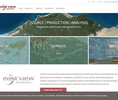
Cloud Computing; Geographic Information Systems; Mapping Tools; Aerial Imaging; Image Processing; Commercial Satellite Imaging; Information Technology Products ...

Visualization Software; Commercial Satellite Imaging; Image Processing; Mapping Tools; Aerial Imaging; Information Technology Products; Geographic Information Systems; Location Based Services ...
Simulation & Modeling & Training; Mapping Tools; Cloud Computing; Consulting Services; Integration Services; Aerial Imaging; Geographic Information Systems; Commercial Satellite Imaging; Image Processing ...
Research & Development; Commercial Satellite Imaging; Engineering Services; Mapping Tools; Aerial Imaging; Image Processing; Consulting Services; Integration Services ...

Visualization Software; Simulation & Modeling & Training; Engineering Services; Image Processing; Research & Development; Aerial Imaging; Information Technology Products; Geographic Information Systems; Integration Services ...
Engineering Services; Information Technology Products; Visualization Software; Mapping Tools; Cloud Computing; Geographic Information Systems; Integration Services; Training & Simulation; Command, Control, Communications & Computers; Aerial Imaging; Image Processing ...

Visualization Software; Consulting Services; Image Processing; Mapping Tools; 3D Mapping Software & Tools; Gis Software; Aerial Imaging; Information Technology Products; Geographic Information Systems; Location Based Services ...
Aerial Imaging; Integration Services; Global Positioning Hardware & Software; Mapping Tools; Geographic Information Systems; Information Technology Products & Services; Weather Services; Computer Software Services & Consultants; GPS Services; Flight Planning Services ...

Geographic Information Systems; Mapping Tools; Aerial Imaging; Simulation & Modeling & Training; Information Technology Products; Visualization Software ...
Simulation & Modeling & Training; Research & Development; Aerial Imaging; Geographic Information Systems; Commercial Satellite Imaging ...

Visualization Software; Research & Development; Cloud Computing; Engineering Services; Mapping Tools; Aerial Imaging; Geographic Information Systems; Commercial Satellite Imaging; Image Processing ...
Drones, Uav, Uas, Rpas, Professional, Commercial, Survey, Imaging, Mapping, Gis; At Sensefly We Develop and Produce Aerial Imaging Drones for Professional Applications; Drones for Professionals, Mapping & Photogrammetry, Flight Planning & Control Software: Sensefly Sa, Solar Power ...
Visualization Software; Eastern & Southeast Asia; Automotive & Vehicle Technology; Mobile Apps; Augmented Reality & Virtual Reality; Central America; Gaming; Central & South Asia; Mapping Tools; Aerial Imaging; Location Based Services; Geographic Information Systems, Virtual Reality ...
Visualization Software; Mapping Tools; Cloud Computing; Geographic Information Systems; Integration Services; Aerial Imaging; Global Positioning Hardware & Software; Commercial Satellite Imaging; Image Processing ...