

Insite, Insite Sitework, Field General, Excavate, Excavation, Earthwork, Cut and Fill, Cut & Fill, Grading, Dirt, Dirtwork, Takeoff, Take Off, Construction Estimating, Construction Layout, Construction Surveying, Earthmoving, Dirtwork, Earthworks Excavation, Pdf Takeoff, On Screen Takeoff, Digitizing, Digitizer, Sitework, Site Work, Machine Control, Heavy Construction, GPS Modeling, GPS Machine Control, Excavation and Grading Programs, Excavation Software, Cad, Autocad, 3D Machine Control, Dirt, Heavy Construction ...

Geotab Telematics Provider for the Utility, Gas and Oil Industries, Construction Equipment, GPS Accessories ...

Land Surveyor, Central Texas Surveyor, Residential Lot Surveys, Land Acreage Surveys, Subdivision Surveys, Alta Surveys, Topographic Surveys, Surveys for Civil Designers, Construction Layout & Staking, GPS Surveys; Surveying Services; ACS Knows Central Texas. Since 1988, ACS has had a unique view of the changing landscape and progress in Central Texas. ACS works daily in Temple, Belton, Waco, Killeen, Georgetown and will go anywhere in Texas to perform survey work; Surveying Service ...

Electronics & Controls & Instrumentation, Communications Cellular, Wireless; Electronics & Controls & Instrumentation, Communications Satellite; Electronics & Controls & Instrumentation, Controls; Electronics & Controls & Instrumentation, GPS Global Positioning Systems; Information Technology, GIS & Mapping; Information Technology, Inventory & Equipment Management; Information Technology, Power & Process & Plant & Utilities; Safety & Security, Alarms; Services, Fleet Management Systems, Construction Equipment ...

Surveying, Leveling, Alignment, Positioning, Layout, Landfill, Agriculture, Gps, Machine, Control, Imaging, and, Scanning, Asset, Management, Service, and, Support, Construction, Technology, Productivity, Positioning; Increase, your, productivity, decrease, your, labor, and, material, cost, and, increase, your, profits. GeoShack, is, the, best ...
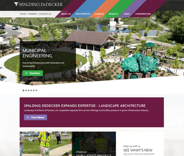
Spalding Dedecker is a Consulting Engineering and Surveying Firm that Specializes in Infrastructure, Land Development and Transportation; Civil Engineers; Topographic, GPS, construction layouts ...

Asphalt Equipment; Material Handling Systems, Asphalt; Information Technology; Construction Management; Electronics & Controls & Instrumentation; Communications & Cellular, Wireless; Information Technology; Inventory & Equipment Management; Electronics & Controls & Instrumentation; Automation Systems; Electronics & Controls & Instrumentation; GPS & Global Positioning Systems, Automation Systems, Material Handling Equipment ...

Land Surveying Lansing, Surveying, Land, Survey, Landsurveyor, Surveyor, Geodetic, Designs, Lansing, Surveys, Alta/Acsm, Alta, Mortgage, Boundary, Topographical, Topo, Topographic, Property, Split, Parcel, Gps, Staking, Construction, Floodplain, Surveyors, Dewitt, Holt, Stakeout, Plotplan, Act132, Property Surveyor, Geodetic Surveyor, Topographic Map, Land Surveyor, Land Surveying, Michigan Surveying, Michigan Land Surveying, Michigan Surveying, Illinois Surveying, Indiana Surveying, Louisiana ...

Preventative Maintenance, Gps, Vehicle Tracking, Vehicle Communication Systems, Fleet Management, Safety, Construction, Mining, Warning Systems, Devices, Monitors, Commercial, Wireless Reporting, Electronics, Information Management, Mining Industry, GPS Accessories ...

Property Surveying, Land Surveyor Connecticut, Ct, Property Lines Surveying, Staking, Survey Property, Fema, Loma, Eloma, Connecticut, Ct, Darien, Property, a 2, A2 Survey, Boundary Surveying & Mapping, Staking Property Lines, Weston, Wilton, Darien, Westport, Best Land Surveyor Stamford, Easton, Greenwich, Fairfield, Elevation Certificate, GPS Survey Control; Capabilities include property & boundary surveys, construction surveying & staking, topographic & site surveys, wetland delination mapping, land ...

Rdo, Rdo Integrated Controls, Gis Mapping, GPS Mapping, Surveying, Agriculture Technology, Construction, Mining, Drone Technology, Drone, Drones, Drones for Sale, Sensefly; Rdo Integrated Controls Partners With Clients To Provide Cutting Edge Technologies and Drones for the Construction, Landfill and Mining Industries; Home Rdo Integrated Controls, Mining Industry ...

Electronics & Controls & Instrumentation, Communications Cellular, Wireless; Electronics & Controls & Instrumentation, Communications Satellite; Electronics & Controls & Instrumentation, GPS Global Positioning Systems; Information Technology, GIS & Mapping; Information Technology, Inventory & Equipment Management; Safety & Security, Alarms; Safety & Security, Anti Theft & Security Systems; Services, Computer Software; Services, Fleet Management Systems; Services, Telecommunications; Services, Construction Equipment ...

InSite SiteWork software for earthwork takeoff, excavation and construction estimating combines ease of use with earthwork take off features for calculating earthwork quantities and software tools for fast, accurate bidding. Easily switch from digitizer takeoffs and use 3D live instant updates to produce accurate layouts, staking data and GPS machine control models ...

Fcc License, Fcc Licensing, Fcc Application, Call Sign, Frn, Form 601, 2 Way Radio License, Microwave, Scada, Gps, Faa Tower, Construction Notice; Assistance With Fcc Licensing Applications; Cara Enterprises, Inc Professional Fcc Application Licensing, Wireless Communications ...

AssetWorks develops fully integrated Fleet Management Software and Fuel Management Systems, as well as the Enterprise Asset Management (EAM) products for Public Works. Our Field Service Solution product offers GPS & Telematics, electronic field ticketing, driver behavior monitoring and ELDs for DOT compliance, Construction Equipment, GPS Accessories ...

Surveying, Engineering, Land Surveying, Austin Texas Firms, Architect, Topography, Vertical Control, Horizontal Control, Gps, Carmelo Macias, Gino Macias, Construction, Level Loop, Boundary Survey, Plat; Surveying and mapping services. Services include engineering, contracting, architects, boundary, route, utility, land, leveling, construction, aerial control and global positioning system ...