

Property Surveying, Land Surveyor Connecticut, Ct, Property Lines Surveying, Staking, Survey Property, Fema, Loma, Eloma, Connecticut, Ct, Darien, Property, a 2, A2 Survey, Boundary Surveying & Mapping, Staking Property Lines, Weston, Wilton, Darien, Westport, Best Land Surveyor Stamford, Easton, Greenwich, Fairfield, Elevation Certificate, GPS Survey Control; Capabilities include property & boundary surveys, construction surveying & staking, topographic & site surveys, wetland delination mapping, land ...

Pls, Pls Survey, Jackson Tennessee Land Surveyor, Tennessee Land Surveying, Land Surveyor, Land Surveying, Professional Land Surveyor, Aerial Imagery, Subdivision Planning, Tn Plotting, Tn Mapping; Surveying Services; Jackson TN Land Surveying Services and Acreage Calculators; Surveying Services ...

Surveying, Engineering, Land Surveying, Austin Texas Firms, Architect, Topography, Vertical Control, Horizontal Control, Gps, Carmelo Macias, Gino Macias, Construction, Level Loop, Boundary Survey, Plat; Surveying and mapping services. Services include engineering, contracting, architects, boundary, route, utility, land, leveling, construction, aerial control and global positioning system ...

Applanix, a wholly owned subsidiary of Trimble, builds, delivers, and supports products and solutions designed specifically for the unmanned aerial survey industry. Our DG technology works with UAV mapping sensors – including cameras, LiDAR, and hyperspectral sensors – to perform highly efficient mapping and surveying from a UAV. applanix ...

Control Freaks at CompassData provide geospatial data products including our global archives of over 50,000 photo id GCPs and over 800 global. 85m airport orthoimages. Services include global GCP survey, mobile mapping, UAS & Drone, airport mapping. ISO and FAA Certified, Asphalt Equipment, Heavy Construction ...
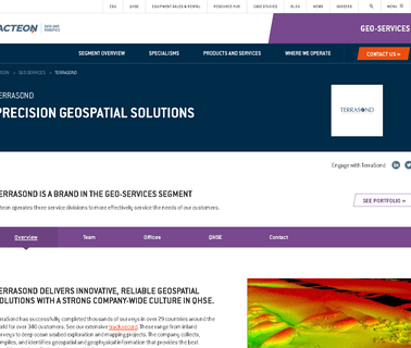
Terrasond Provides Hydrographic, Marine Geophysical, Land Survey Services, Mapping and Charting and Cable / Pipeline Support Surveys with an Experienced Team; Surveying Services ...
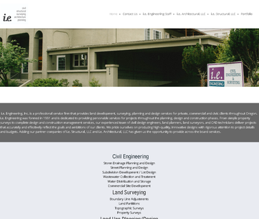
Ie Engineering Professional Services, Engineering, Structural, Survey, Alta, Boundry Surveys, Construction Surveying, Bridge, Structural, Plats, Platting, Mapping, Geodetic, Gps, Civil, Land Development, Water Resources, Transportation, Transit, Land Surveyors, Project Managers, Planning, Gis, Hydrographic, Environmental, Wetlands, Landscape Architecture, Oregon, Roseburg, Douglas County; Civil Engineering Services Including Land Surveys, Storm Drainage Planning & Design, Street Planning & Design, Water ...
Drones, Uav, Uas, Rpas, Professional, Commercial, Survey, Imaging, Mapping, Gis; At Sensefly We Develop and Produce Aerial Imaging Drones for Professional Applications; Drones for Professionals, Mapping & Photogrammetry, Flight Planning & Control Software: Sensefly Sa, Solar Power ...

Gis, Aerial Survey Acquisition, Aerial Photography, Digital Orthophotography, Color, Cir, Color Infrared, Black and White, Remote Sensing / Lidar, Topographic Mapping, Planimetric Mapping, Alabama, Arkansas, Colorado, Connecticut, Delaware, District of Columbia, Florida, Georgia, Idaho, Illinois, Indiana, Iowa, Kansas, Kentucky, Louisiana, Maine, Maryland, Massachusetts, Michigan, Minnesota, Mississippi, Missouri, Montana, Nebraska, Nevada, New Hampshire, New Jersey, New Mexico, New York, North ...

Jsd Professional Services, Jsd, Madison And Milwaukee, Wi, Central Wisconsin, Midwest, Civil Engineering, Land Surveying, Site Engineering, Transportation Engineering, Engineering Job Search, Surveying Jobs, Jenkins Survey & Design, Engineering Consultants, Surveys, Surveyor, Water Resources, Land Surveyors, Planning And Development, Site Civil Engineering, Construction Management, Storm Water Management, Surveying And Mapping, Surveyors, Development ...

Ehang, Ehang Website, Smart Drone, Mobile Phone Control Drone, Manned Drone, Ehang 184; Ehang, is An Innovative, Technology Oriented, Enterprise That is Specializing In Smart Drone. the Ghostdrone Series Utilizes a Unique Way of App Control, Which Reduce the Threshold To Common User. These Innovative Drone Products Developed By Ehang Can Be Widely Adopted In Different Industries Including; Filming, Landscape Mapping, News Gathering, Energy Resource Survey, Search & Rescue, Investigation, Technology Industry ...
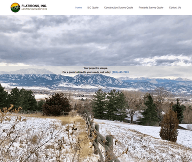
Colorado Land Surveying; Surveying Services; Free consultation and estimates for your land surveying and engineering needs. -. Serving Boulder, Denver and Colorado Front Range since 1981. Whether you're a homeowner, commercial land owner or government official, buying or selling, locating property corners, looking for a boundary survey, lidar, doing a condo map or constructing townhomes, we can meet your needs; Contractor For Surveying Services Which Include Pin Surveys, Aerial Mapping & Right-of-way ...

Consulting Services; Conversion Services; Drafting Services; Engineering Services; Modeling Services; Rendering Services; Research, Design and Development Services; Surveying Services; Website Services; We offer solutions for cad drafting & designing services. Our specialization lays in land survey drafting, architectural drafting and cad conversions ...
Computers & Software; Software Applications; Test Equipment; Test Equipment; Wireless Communications Tower & Site Equipment; Wireless Communications Towers & Site Equipment; Wireless Communications Networks; PROJECT 25; DMR; LTE (Long Term Evolution); RF; Coverage Mapping, Wireless Communications ...